SpaceNet 3: Road Network Detection
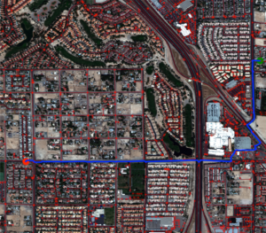
Millions of kilometers of the worlds’ roadways remain unmapped. In fact, there are large organizations such as the Humanitarian OpenStreetMap Team (HOT) Missing Maps Project whose entire goal is to map missing areas. The SpaceNet 3 Road Detection and Routing Challenge was designed to assist the development of techniques for generating road networks from satellite imagery. The deployment of these techniques will hopefully expedite the development and publication of accurate maps.
The Challenge specifically asked participants to turn satellite imagery into usable road network vectors. For this challenge, we created a new metric, Average Path Length Similarity (APLS) for evaluating the similarity between a ground truth and proposal road network. We also created new feature labels specifically for this challenge. The new dataset consists of 8,000 km of road centerlines with associated attributes such as road type, surface type, and number of lanes. All roads were digitized from existing SpaceNet data — 30 cm GSD WorldView 3 satellite imagery over Las Vegas, Paris, Shanghai, and Khartoum.
The challenge was conducted from November 2017 to February 2018 and hosted on the Topcoder platform. It received 342 submissions from 33 challenge participants from the across the world. The code for the top five submissions were open sourced under the Apache 2 License on SpaceNet Github repository.
CosmiQ Works conducted this project in coordination with the other SpaceNet Partners: Radiant Solutions, Amazon Web Services, and NVIDIA.
Learn more at www.spacenet.ai.

