• Skip to main content
CosmiqWorks
  • cosmiqworks-logo-r@2x
  • Projects
  • Blog
  • Podcasts
  • Resources
  • About
  •         

SpaceNet 5

August 1, 2019 by rocky

SpaceNet 5

Road Network Detection, Routing Information, and Travel Time Extraction

SEE ALL PROJECTS

SpaceNet accelerates research and innovation in geospatial machine learning by developing and providing publicly available commercial satellite imagery and labeled training data, as well as open sourcing computer vision algorithms and tools.

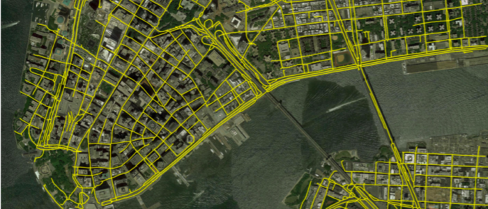
The SpaceNet 5 challenge focused on road network detection and routing information and travel time extraction. Optimized routing is crucial to a number of challenges, from humanitarian to military. Satellite imagery may aid greatly in determining efficient routes, particularly in cases of natural disasters or other dynamic events where the high revisit rate of satellites may be able to provide updates far faster than terrestrial methods.

Learn more at www.spacenet.ai
9_SN5_Text_Block_Image

RELATED POSTS

  • The SpaceNet 5 Baseline — Part 3: Extracting Road Speed Vectors from Satellite Imagery
  • The SpaceNet 5 Baseline — Part 2: Training a Road Speed Segmentation Model
  • The SpaceNet 5 Baseline — Part 1: Imagery and Label Preparation
  • Computer Vision With OpenStreetMap and SpaceNet — A Comparison
  • SpaceNet 5 Dataset Release
  • Announcing SpaceNet 5: Road Networks and Optimized Routing

Filed Under: Archived Projects Tagged With: datasets, models

  • Projects
  • Podcasts
  • Blog
  • Resources
  • About

  • Copyright © 2019 · IQT Labs LLC - All Rights Reserved | Terms of Use | Privacy Policy

We use cookies to analyze the usage of our websites and give you a better experience. You consent to our cookies if you click on “Agree” and continue to use our website. Read our Privacy Policy for more information and to know how to amend your settings.AgreePrivacy policy